
Off the Beaten Track 10 - Miles of Prehistoric Landscapes
Published: 05 June 2020
The quality and density of the Neolithic/Bronze Age landscapes of the West Mainland never cease to inspire me. There are many wonderful walks amongst them, but today’s suggestion starts at the Scord of Brouster. It was excavated in the late 1970s, which means that it is slightly easier both to see and to understand.
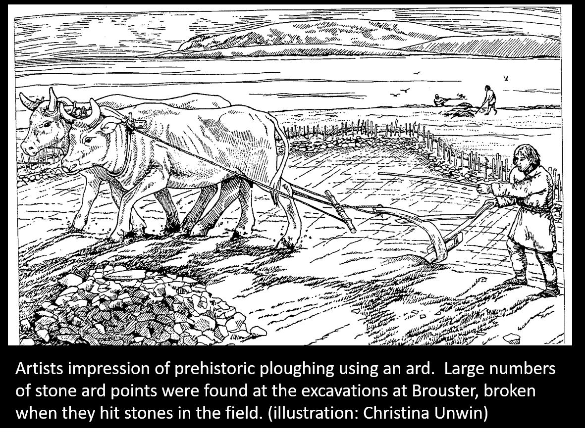
Such prehistoric settlements may have started as Homestead Enclosures (see 'Off the beaten track 3'). Additional fields were gradually added to the original enclosure. Radiocarbon dates from the Scord of Brouster suggest that this farm developed over about 1000 years, spanning the Neolithic and Bronze Ages. Examining pollen cores suggested that the farm may not have been used continuously for the whole period. During its occupation, the location of the house changed twice. The earliest stone-built house overlaid an earlier wooden building. The visible stone remains are so extensive that it is easy to forget there could be as much which we can’t see, originally built in wood. Like the early wooden house at Brouster, finding wooden remains depends on both good preservation and good luck.
 Another feature of these West Side farms are lengths of dyke apparently running between the settlements and into the hills, sometimes ending at chambered cairns. The dykes appear and disappear in and out of the peat. Archaeologists have mapped them over long distances and they seem to mark out territories or outfield boundaries. These prehistoric landscapes remain virtually untouched since they were abandoned, when a combination of peat creeping down the hills and repeated cultivation made the soils incapable of supporting crops. In 2010, a team of archaeologists mapped 10 square kilometres of the prehistoric landscape but realised that the prehistoric area was even more extensive. The long-distance dykes appear to be land divisions, dividing up the West Side. It seems that the prehistoric inhabitants needed to know who owned which part of the hillside and its resources, presumably peat (which was used for fuel from the middle of the Neolithic), stone (there are examples of quarries where stone tools were made in the hills), grazing and even the shore, (perhaps including very valuable rights to stranded cetaceans and drift wood). However, excavations of the farms, and dating evidence for them, are extremely limited and it is possible that not all of these settlements were in use at the same time.
Scord of Brouster - Voxterby
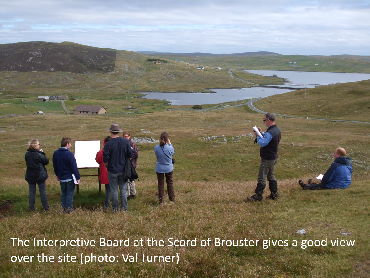 There is a parking bay at the Scord of Brouster (HU 255 516), a short distance along the road to Sandness, just beyond the Bridge of Walls. The interpretation panel is visible on the hill from the gate at the verge. It’s worth going up, not only to see the panel but also because it is a good vantage point for the site. If you have two cars and would like to make this a linear walk, or if you would prefer to start at the other end, there is a track which goes into the Voxterby area. To find that, from the main road to Walls, take the minor road to Brindister and West Burrafirth, at Murraster. The track leaves the minor road at HU 278 543.
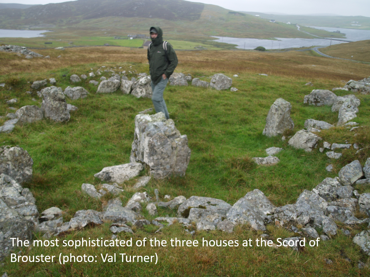
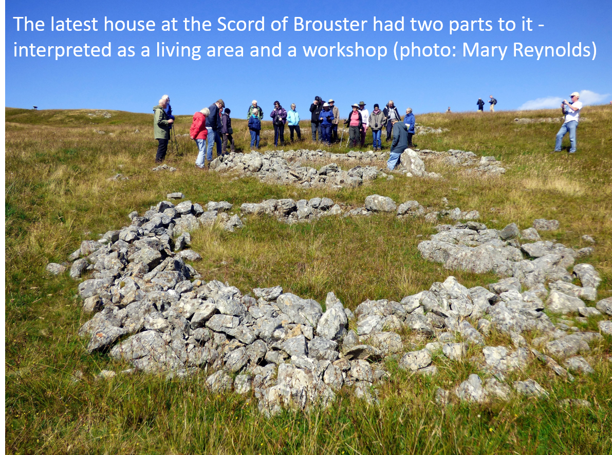 At the Scord of Brouster, there are stone-built remains of a small, irregular, oval field boundary lying close to the road. It is unusually easy to see the whole outline of the field because it was uncovered during the excavations. The field has a large oval house attached to the northern end. Inside the house, a central hearth is surrounded by stone-built cells which are set against the walls and divided from one another by massive boulders. This house was the second stone house in the sequence and its remains are the most sophisticated of the three buildings. Close to it there is a very clear Bronze Age circular ring cairn with a kerb of large boulders, but this was built after the settlement had been abandoned. There are two other house sites to the north, amongst the fields which, in total, enclose about 2 hectares. The fields are littered with clearance cairns, where stones from the fields were heaped into piles, although you might think that this would hinder agriculture rather than help it.
 Heading northwest towards the loch (HU 257 517) you can see a series of prehistoric features, including an enclosure, a hut circle, a number of possible burnt mounds, clearance cairns and fragments of field boundaries. There are also several plantiecrubs, which often overlie archaeological remains which were a ready-made source of stone. The best preserved burnt mound is about 11 metres long, but being later Bronze Age it may be later than the rest of the settlement.
Continue a short distance north to discover the remains of a third settlement on Brace Field (HU 257 521). Here there are at least two, and possibly four, house sites set amongst fragmentary lengths of field wall and two oval enclosures. Without excavation, it is impossible to know how long this settlement lasted.
The fourth settlement is on a terrace on the northeast shore of the Upper Loch of Brouster (HU 260 523). Here is a prehistoric round house, a second structure which might be another house, and some fragmentary dykes. The dykes appear to have been part of two enclosures set against the shore of the Loch and the Brace Burn.
The fifth prehistoric settlement on this walk is on the opposite side of the Loch of Voxterby (HU 260 538). This involves either crossing Brace Burn or walking right around the loch. It is worth the effort as there are as many as six possible oval houses, with associated infield remains and dykes.
If you decide to cross the burn near the Upper Loch of Brouster, you can visit the remains of a burial cairn (HU 263 524). With so many settlements in the area, it is not surprising to find burial places in higher locations.
As you pass the southern of the two largest islets in the middle of the Loch of Voxterby (HU 261 535), you might spot a mound on the skyline which is greener than the surrounding heather. It is possible that this could be a burial cairn, although I suspect that no archaeologist has had the opportunity to visit it. The northern islet (HU 259 536) is connected to the land by a causeway and may also have been significant in the past, whether for grazing or for defence.
If you have chosen to walk around the top of the loch, you will cross the remains of even more dykes on the way. A low terrace rises above the northern end of the loch. This is the site of a burial cairn, which survives as a mass of stones and boulders protruding through the peat and heather.
One tip before you go – on this walk, not only will you cross patches of rough heather, you will also encounter areas of bog. Make sure you walking boots are reasonably waterproof!
Dr. Val Turner, Regional Archaeologist, Shetland Amenity Trust
We hope you have enjoyed this blog.  We rely on the generous support of our funders and supporters to continue our work on behalf of Shetland. Everything we do is about caring for Shetland's outstanding natural and cultural heritage on behalf of the community and for future generations. Donations are welcomed and are essential to our work.