
Off the Beaten Track 6 - Walking with Vikings
Published: 08 May 2020
With the Government now agreeing that people can drive to places for exercise as long as they walk for longer than it took to drive there, it opens up more possibilities for archaeological walks. Since ferries are still only for emergency use, for now these Viking themed walks are exclusive to people living in either Unst or Bressay.
The beaches in Unst are second to none and I would be hard put to decide which of them is my favourite Shetland walk. This week I am going to focus on Sandwick, known locally as the Easting. (I hope to explore Underhoull to Lund another week.)
Before we begin, just a note about the terms Viking and Norse. The word “Viking” literally means “pirate” or “raider”, which suggests that it should only apply to the early appearance of Scandinavians in Shetland. However, in Scotland, the word usually applies to the time they first appear to about 1050AD. Their way of life continued in Shetland for another 400 years, when the language, laws, religious and political structures were predominantly Scandinavian, and is generally referred to as “Norse”.
A Viking Shoreline (HP 620, 021 - HP 619, 032)
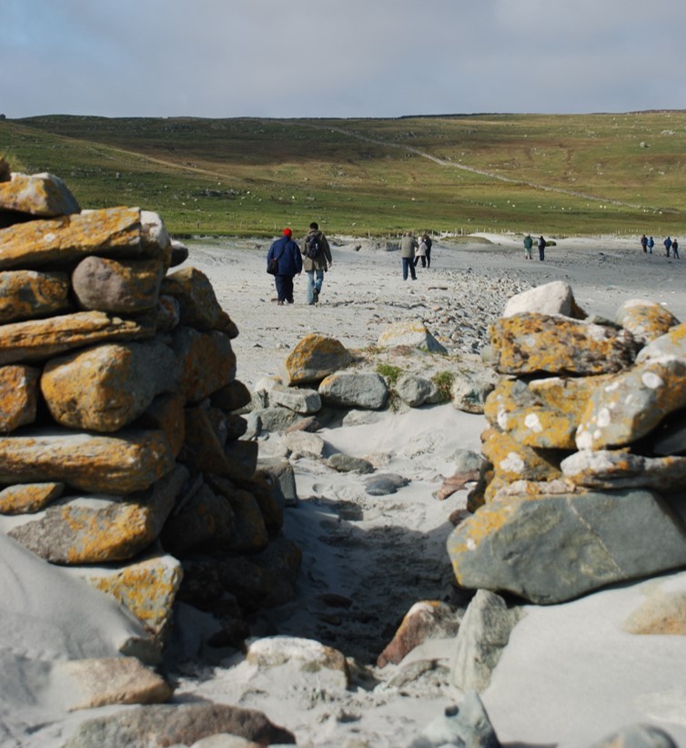
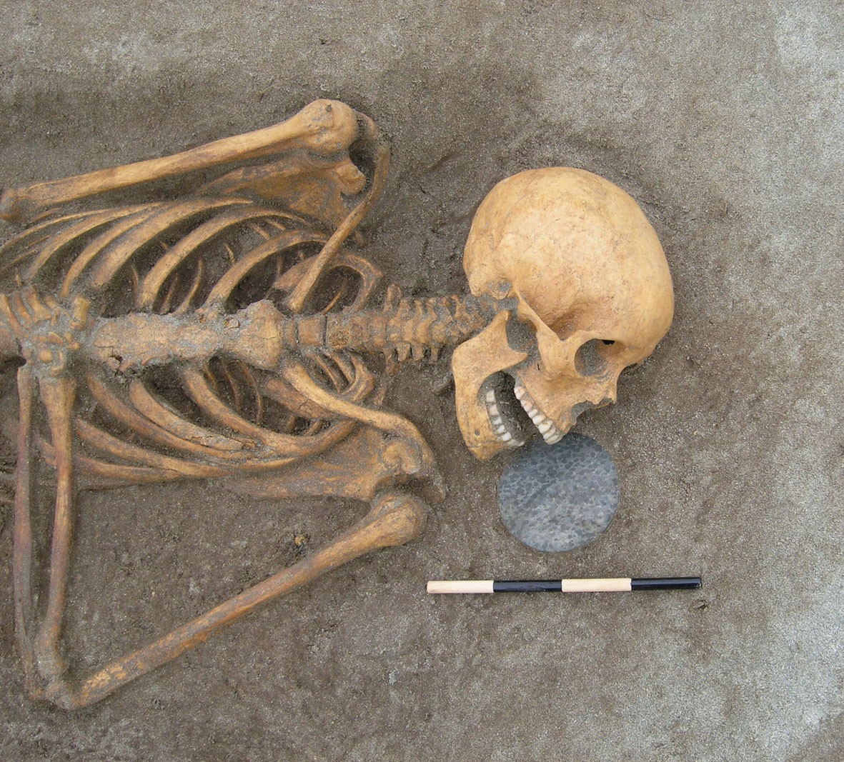 The car park at Hannigarth marks the starting point for a beautiful out and back walk to the Easting, Unst. Follow the path to the crofthouse, then follow the way markers down the hill, towards the beach. At the top of the banks, turn left and you’ll come to a Pictish (Late Iron Age) house, the location of a community excavation in 2004 - 2007. Most of the settlement was already lost to the sea, but what survived was consolidated. The upright stones at the base of the wall are give-away signs that this was Pictish. When the building was abandoned, sand filled it rapidly and a grave was dug into the top. Two other Pictish burials had already been found on the beach close by. One burial was covered with a cairn of quartz pebbles. The other had a polished stone disk near the skeleton’s head.
Back-tracking for about 250 metres north, and literally on the beach, there is a late Norse farm, known to archaeologists as Sandwick South. There is also a rather ancient interpretive board beside it. The farm becomes more and less impressive, depending on the weather. A storm can either almost cover it with sand, or alternatively scour all the sand out of it. Of course, the Norse farmers didn’t intend to live quite so close to the sea, but the coastline here has moved inland, even within living memory. Judging by the number of fishing hooks and line sinkers found, fishing was as important here as farming. The building looks like a longhouse with side rooms. Drains were found in one, leading to speculation that it was a toilet.
 The north end of the longhouse was laid out as a byre. It intrigued archaeologists that longhouse doors in Viking byres were often narrow, as is the case at Jarlshof. The walls at Sandwick South solved the puzzle, as they survived over 1 metre high. They were narrow at the bottom, but then curved outwards - the door was cow-shaped.
There were two further settlements on this beach. Halfway along, the remains of an earlier Viking settlement has largely been washed away by the waves. And at the far end of the beach there is a Viking midden (waste heap). It belonged to a now lost settlement. Over the years, people picnicking here have sunk their fingers into the sand - and encountered Viking objects, including a piece of bone comb. If you are in that fortunate position, please send me photos and do take your finds to the Museum when it reopens.
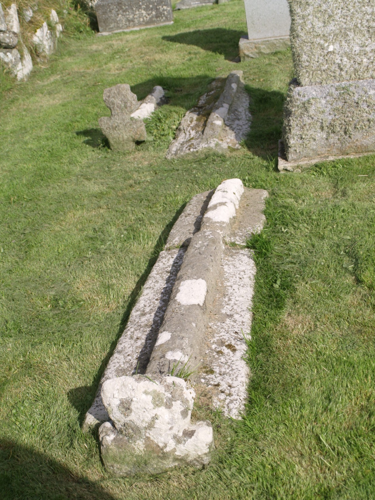 Leaving the beach and crossing a stile, it’s only a short distance to Framgord chapel. The graveyard contains some very unusual Viking/Norse keelstones (long thin grave slabs with a ridge along the centre, rather like the keel of a boat). One has a cross-piece and looks rather like a sword. There is also a group of small carved stone crosses, which could have a Viking date. Just outside the kirkyard gate are the remains of what looks like a very large Viking/Norse farm. It has never been excavated, but its size and the fact that it had its own chapel suggest that it was the head-farm for the area.
If you continue north, you soon come to the deserted croft of Smirgarth, which seems to have been built over the remains of another longhouse. At the shore there is a series of noosts, presumably where Viking longships would once have been moored.
You have to retrace your steps on this walk, but I once saw an otter cross the beach in front of me as I was doing exactly that.
Cullingsbrough, Bressay (HU 522,423)
Cullingsbrough is a gentle stroll from Setter. There are horizontal mills along the burn, a burnt mound, and the remains of a 19th century fishing booth. There are also the remains of a township, with 14 buildings (7 unroofed) recorded in 1881. The end point of the walk is a chapel. Intriguingly, this is the only cruciform (cross-shaped) church in Shetland, although that is probably due to being enlarged in the early 17th century. So why include it with a Viking walk?
Firstly, the chapel’s graveyard is built over the remains of a broch. It wasn’t unusual for medieval (Norse) graves to be dug into the tops of ruined brochs, perhaps because the ground there was not suitable for much else. We know that the original chapel had early origins because a cross slab, probably dating to the 10th century, was found here.
There is a replica of the original in the graveyard. On one side the carving looks as if it is a crude copy of the cross slab from Papil, Burra. On the other side, there is an interlaced cross above which are two animals, apparently eating someone. There are two monks or priests below the cross, and a third riding a horse, as well as a lion and a smaller animal, perhaps a pig. But most notably, there is an ogham (Pictish writing) inscription along both of the edges of the slab. The inscription reads “the cross of Nadd Oddr’s daughter [A]nn [something missing] Benises son of Droan”. Strangely, the word used for daughter is Norse, while those for cross and son are Gaelic. This cross slab is altogether a bit of a conundrum. Was Ann of mixed Pictish and Viking heritage? Is this the attempt of a Viking to write in ogham since there are two dots, like a colon, between the words on other Shetland rune stones?
There are also some interesting 17th century tombstones in the graveyard, including a table tomb, a slab commemorating Agnes Gifford who died in 1628, and another in Dutch. This last one commemorates a captain in the Dutch East India Company who died in Bressay Sound whilst returning home from Mozambique in 1636, having fought through gales with a crew dying of disease.
Remember that the Government advice was due for review yesterday and that the guidance about exercise might change. Let’s hope that we are allowed to walk more.
Regional Archaeologist, Val Turner of Shetland Amenity Trust
We hope you have enjoyed this blog.  We rely on the generous support of our funders and supporters to continue our work on behalf of Shetland. Everything we do is about caring for Shetland's outstanding natural and cultural heritage on behalf of the community and for future generations. Donations are welcomed and are essential to our work.