
Off the Beaten Track 3 - Homesteads
Published: 10 April 2020
As the Government continues to emphasise that our exercise periods should be close to home, why not go on a hunt for less dramatic, but much more commonly found, archaeological sites which could easily be on your doorstep?
Have you ever noticed the large number of times that the word “Homestead” appears in italics on the large scale Ordnance Survey maps? “Homestead” is usually shorthand for a single early prehistoric house (Neolithic or Bronze Age). One of the joys of these is that they are shown in locations all over Shetland, so there is a high chance that there will be one close to your home.
Prehistoric houses come in a variety of shapes: round, oval, heel-shaped and resembling a figure-of-eight. They seemed to evolve over time, and twenty years ago archaeologists thought they had begun to understand the sequence. While there may be an element of truth in that, we now know that the situation is far more complicated.
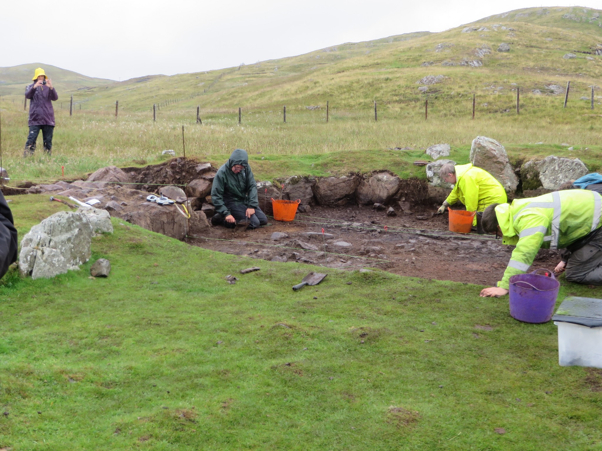 Two summers ago Claire Christie excavated a prehistoric house site at Troni Shun, between Walls and Sandness, in the belief that it was a Neolithic house. She discovered that, whilst it was built in the early prehistoric period, it had been adapted and reused in the Late Iron Age (Pictish) period. This was completely unexpected - but curiously, 30 years ago when I first came to Shetland, these sites were often referred to locally as “pecht’s hooses”.
The single houses were often, although not always, enclosed by a yard or field. Traces of the boundary can be continuous or fragmentary, obvious or barely visible, surviving as a bank, dyke, line of stones, or a lynchet (a one sided bank with a drop in ground level, whether inside or outside). The enclosed area is usually irregular but fairly compact. Sometimes it is clear that the irregularities come from a desire to make use of earth-fast stones. In other cases, such as the kidney bean shaped enclosure at the Hill of the Taing in Nesting, perhaps the boundary avoided an obstacle, such as a tree or obstacle which has long since disappeared into the peat.
Although they occur in most areas, Nesting seems to have an abundance of “Homesteads”. Although it could partly be explained by the comprehensive survey of South Nesting carried out by Shetland Amenity Trust and Bradford University in the early 1990s, it appears unparalleled. Some sites never found their way onto Ordnance Survey maps and may not yet be on Shetland’s Historic Environment Record. It is very possible that you might know about one which is missing.
In the 1870s, soldiers visited every part of Shetland to collect place names and information, to create the original Ordnance Survey maps. Some got very enthusiastic about their work and gathered detailed information, not only about place names but also archaeological sites. The quality of their work varied, not only with their own interest but also with the knowledge of their informants - it needed three “authorities” to verify information, names and spellings. The “authorities” were frequently the laird, the schoolteacher and the minister – unfortunately, these were often the people who knew the least about the land. Later surveys concentrated on areas where archaeology was already recorded, and so the gaps in our knowledge persisted. Shetland Amenity Trust’s Archaeology Team has been trying to close some of those gaps over the past 30 years.
You can check whether examples which you see are on the Shetland Historic Environment Record (also known as the Sites and Monuments Record) by looking online at Pastmap (pastmap.org.uk). This database draws on a plethora of data sets about Scotland’s archaeology. If you navigate to the area you are interested in, check the box labelled HER. This shows you the sites held on the record kept at Shetland Amenity Trust. (The update happens every 6 months, so there is always a time delay between reporting a site and seeing it online.)
There is a remarkable series of “Homesteads” beside the South – North Nesting road. There are three in North Newing (HU 467,559) and two more at South Newing (HU 477,567). Others in South Nesting include Whalsay Willie’s Knowe (HU 463,544, beside a track), Benston (HU 460,538, east of the loch) Vassa (HU 462,528, on a low rise beside the voe), two at Finnister (HU 462,517) with a good view to Gletness, and Hill of the Taing (HU 461,516) which is the highest of them all and is more of a hill walk – the “Homestead” is close to the trig point.
Another, less visual, example was found and partially excavated during the “Homesteads” 1990s South Nesting project. To find it, cross the field in front of South Nesting Hall; it is just beyond the fence at the far side. Although the house was badly disturbed more recently, the hearth survived in the middle along with a number of stone tools and 25 pieces of pottery. The enclosure wasn’t immediately obvious, but a hill dyke bounded an area with soil marks left by prehistoric ploughing (ard marks). These soils had been cultivated in early prehistory. We were surprised to find the remains of a chambered cairn close by (house sites and burial cairns are rarely found together).
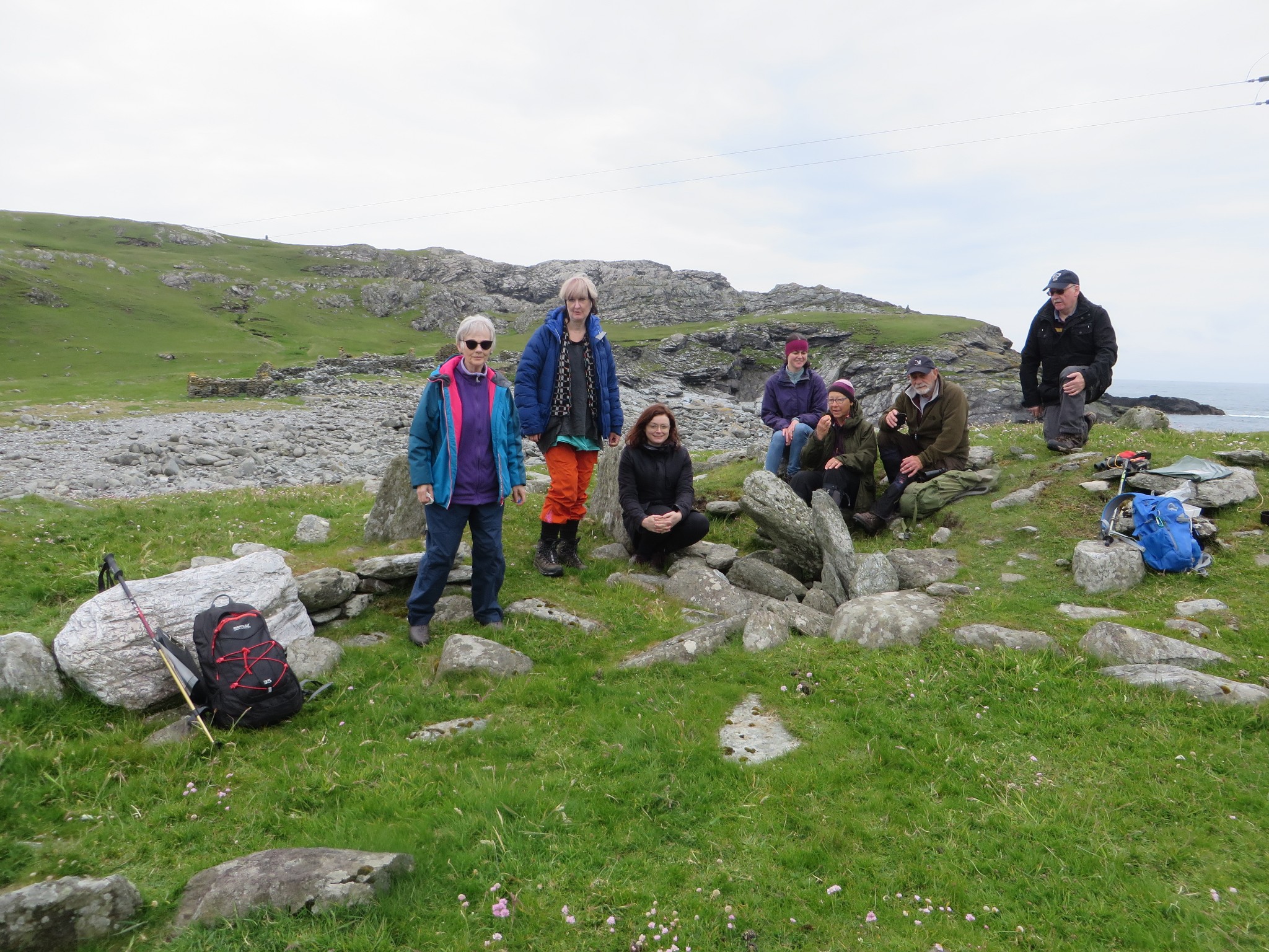
Many of the Nesting sites are easy to access, being very close to the road. Please remember to be responsible and follow the Scottish Outdoor Access Code (shutting gates and not taking dogs into fields of livestock).
 For an excellent example, I’d recommend the walk to the “Homestead” just beyond the beach at the fishing station at Fethaland (HU 3735,9429). It has a 7m long entrance passage, the end of which was marked by othostats (large stones on end) on either side. They probably helped to support the roof, as well as looking impressive. More orthostats divide the central space into side rooms. The site was dug into in 1905, but in 1946 the Royal Commission on Ancient Monuments incorrectly classified it as a broch.
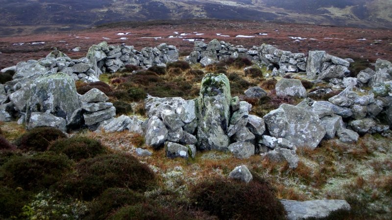 There is an exceptionally large “Homestead” on the Hill of Burwick, above Asta, Tingwall (HU 3975,4160). It has six orthostats in the inside wall and two others outside, which makes it look like Stanydale Temple. However, beware, the walling between the outer stones is part of a recent sheep enclosure. The surrounding enclosure survives as a bank and a few large stones nestling amongst the heather.
So why not grab your jacket and have a search? And if you do find something which you think is missing from our record, please do get in touch.
Regional Archaeologist, Val Turner of Shetland Amenity Trust
We hope you have enjoyed this blog.  We rely on the generous support of our funders and supporters to continue our work on behalf of Shetland. Everything we do is about caring for Shetland's outstanding natural and cultural heritage on behalf of the community and for future generations. Donations are welcomed and are essential to our work.